
Mini France has managed to successfully offer a virtual Mini experience with the help of a Social/Google Maps mash-up advergame called “Mini Maps”.
With DDB Paris and Unit9 they created a Facebook app that lets you customize a virtual Mini and then challenge Facebook friends to time trials around the world through Google Maps. In the challenge you are racing your friends over satellite images of your favorite locations around the world!
Why this works
- The idea is instantly graspable. Customize your Mini. Pick a place. Race the clock. Challenge friends.
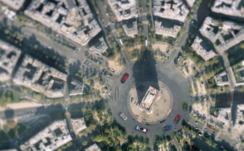
- Google Maps is not a backdrop. The satellite layer becomes the playable surface, which makes every track feel personal.
- Social competition is built in. Time trials make it easy to compare performance without complex multiplayer setup.
What this signals for interactive brand experiences
When a brand turns a familiar utility into a game environment, the brand becomes the interaction. “Mini Maps” uses location as the hook, customization as the commitment step, and friendly competition as the retention loop.
A few fast answers before you act
What is “Mini Maps”?
“Mini Maps” is a Facebook advergame for Mini France that combines social sharing with Google Maps to create location-based time trial races.
What does the viewer actually do?
You customize a virtual Mini and then challenge Facebook friends to time trials across Google Maps locations, racing over satellite imagery.
Why is Google Maps central to the experience?
Because it provides the world itself. The satellite view turns real places into tracks, which makes the challenge feel more personal and replayable.
What is the reusable pattern here?
Start with a concrete action (customize), move to a simple challenge mechanic (time trial), then let social competition drive repeated return visits.